Coorg, also called Kodagu, is a small district in Karnataka state. It is the most popular and tourist’s favorite hill station in southern India, Also called “Scotland of India” due to its mountainous, misty and cool weather, Coorg is located on the eastern slopes of the Western Ghats.
Madikeri City is the headquarters of coorg which is framed by mountains from all the sides. As in song “Madikeri mel manju” which means mist over madikeri, it is always covered by mist all over the year.
Snaky roads, aroma of coffee blossom, greenly coffee plantation, trees swallowed by pepper vine, slow moving sea waves like mountains covered with green forests, tea estates, songs of birds, misty and cool weather, homemade wines and chocolates , Coorg special spices, pollution and stress free environment, Coorg special dishes, heavenly cottages, home stays giving a feel of home away from home , cool and party freak people-all this features of Coorg, makes it a heartthrob tourist centre for tourists.
Abbey falls, Omkareswara temple, raja seat, Madikeri fort, gaddige, Talakaveri, Bhagamandala, Kaveri nisargadhama, Irupu falls, Chelavara falls, Nagarahole reserved forest, Malhalli falls, Golden temple, Dubbare elephant camp, Mandalpatti, Nalknad palace, Igguthappa temple, Harangi dam, Yemmemadu dargah, Chiklihole reservoir are some of the must visit places in Coorg.
Thadiyandamol hill, Kotebetta, Pushpagiribetta, Brahmagiri are the trekking places for trekking lovers.
We Skanda coorg travels with experienced drivers and travel guide help you & your loved ones to explore coorg. We make your stay and travel in coorg comfortable, give you everlasting beautiful memories.
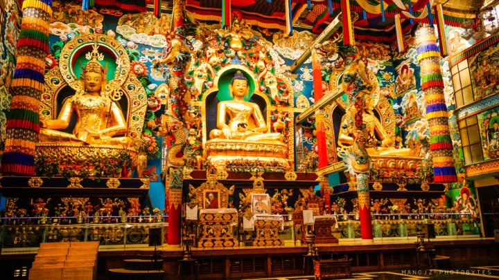
Golden Temple
Bylakuppe is an area in Karnataka which is home to the Indian town Bylakuppe and several Tibetan settlements (there are several Tibetan settlements in India), established by Lugsum Samdupling (in 1961) and Dickyi Larsoe (in 1969). It is located to the west of Mysore district in the Indian state of Karnataka which is roughly 80 km from Mysore city. Twin (Indian) town Kushalanagar is about 6 kilometres (3.7 mi) from Bylakuppe. It also shares the border with Eastern part of Coorg district.
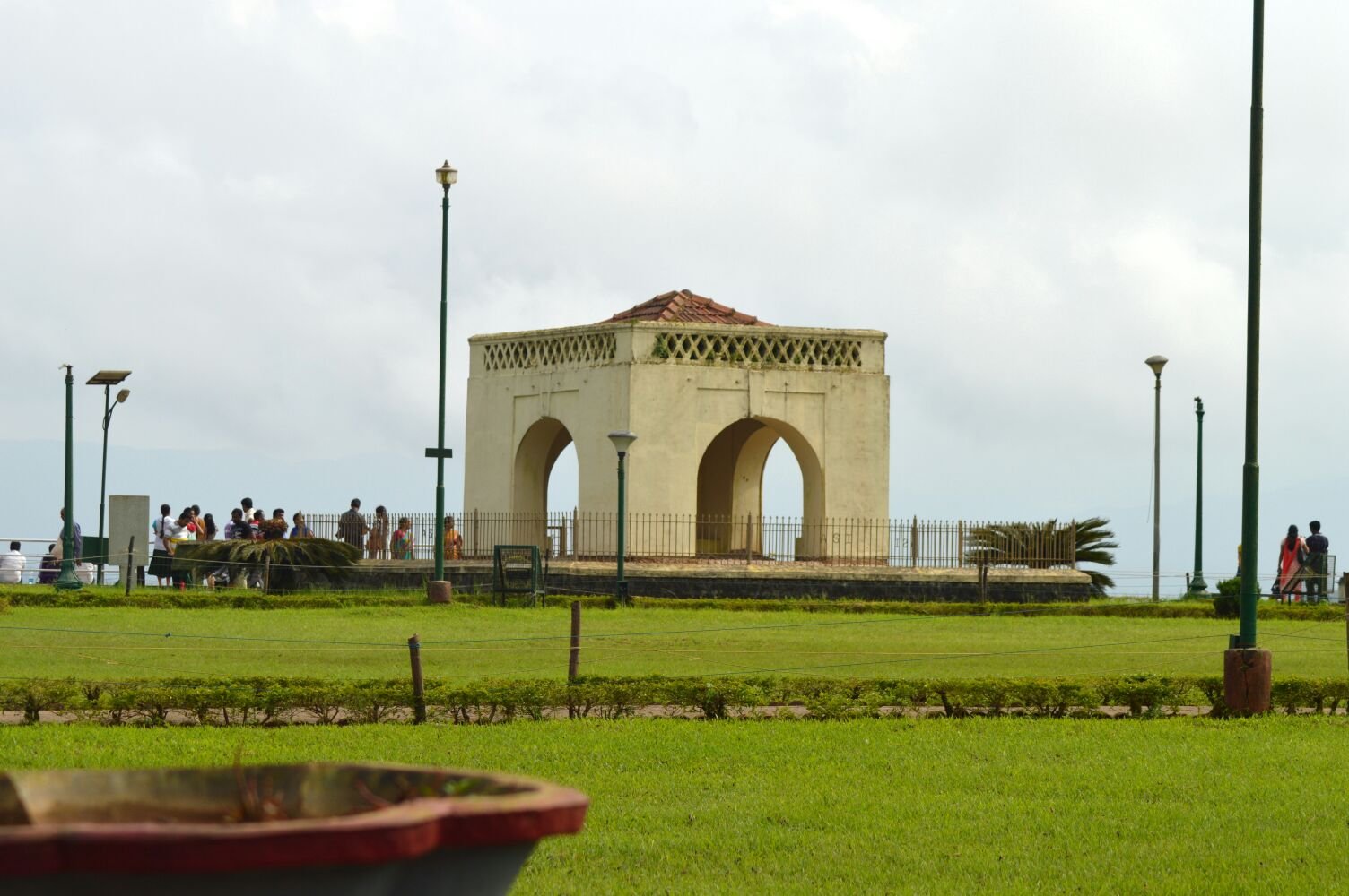
Raja Seat
Raja Seat (Seat of the King) is a seasonal garden of flowers and artificial fountains. It is one of the most important tourist spots in Madikeri of Kodagu District. A pleasant spectacle of refreshing layers of greenery, chain of high and low-rise-mountains attired with mist, the Raja Garden is one-time-favourites of Kings of Kodagu who used to watch the setting sun, and spend time with their queens here. The structure is small square in brick and mortar of four pillars bridged by arches, enhanced by beautiful surroundings. This lovely spot was a favourite place of recreation for the Rajas and hence was permanently associated with them. It is built on a high level ground with a commanding view of the cliffs and valleys to the west. Early in the morning as the sun is just rising in the east, the mist shrouded valley below offers a rare sight. The golden light of the setting sun is a splendor to watch. There is also an attraction of the Toy Train for children.
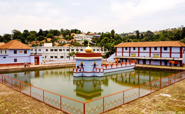
Omkareshwara Temple
A beautiful temple in Madikeri. A legend is associated with the temple, built by Lingrajendra II in 1820 CE. The king put to death a pious Brahmin who dared to protest against his misdeeds. The spirit of the dead man began to plague the king day and night. On the advise of wise men, the king built this temple and installed a shivlinga procured from Kashi, North India.
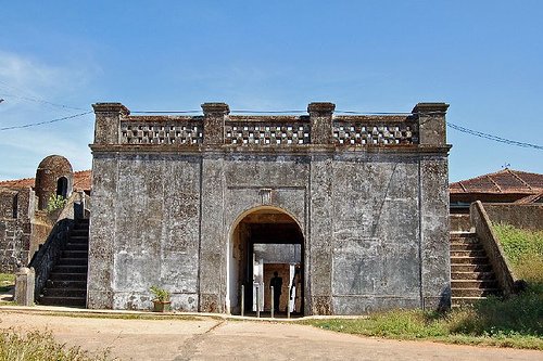
Madikeri Fort
Madikeri Fort was first built by Mudduraja in the last quarter of the 17th century. He also built a palace inside the fort. It was eventually rebuilt in granite by Tipu Sultan who named the site as Jaffarabad. In 1790, Doddavira Rajendra took control of the fort. The British who added to the fort in 1834. The palace was renovated by Lingarajendra Wodeyar II in 1812-1814. In the north-east corner at the entrance are two life size masonry elephants and a church is present in the south-east corner which is now turned into a museum.
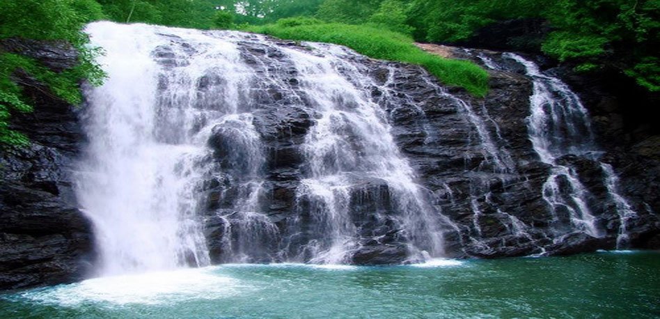
Abbey Falls
The waterfall is located between private coffee plantations with stocky coffee bushes and spice estates with trees entwined with pepper vines. The falls appear suddenly, the water cascading over rocks into calm pools. A hanging bridge constructed just opposite the falls comes in handy for the Tourists. In the mountains of the Western Ghats, several streams combine, swelling with the monsoon rains and plunging down the mountain slope at enormous speed, hitting the huge boulders hard and forcing through the crevices and ravines. A misty cloud hangs over the falls. From here the water flows into the Kaveri River.
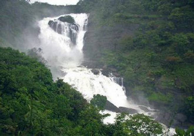
Mallalli Falls
Mallalli Falls is situated in the Western Ghats region of Kodagu District. Mallalli falls is situated in the foothills of pushpagiri, around 25 km from Somwarpet. The Kumaradhara river is the main watercourse for this waterfall. It later flows through Kukke Subrahmanya and merges with the Netravati.
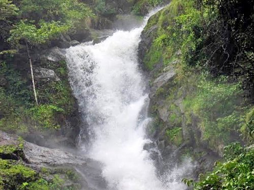
Iruppu Falls
The Irupu Falls is located in the Brahmagiri Range in the Kodagu district. It is a fresh water cascade and is situated at a distance of 48 km from Virajpet on the highway to Nagarhole. The Falls are also known as the Lakshmana Tirtha Falls, derived from the name of the tributary of Cauvery which starts from these falls, the Lakshmana Tirtha River. A forest trail leads from these falls to the Brahmagiri Peak in Southern Kodagu. Irupu falls is a major tourist attraction as well as a pilgrimage spot. A famous Siva temple, the Rameshwara Temple is situated on the banks of the Lakshmana Tirtha River, en route to the Falls. This temple attracts a large number of pilgrims during the festival of Shivaratri.
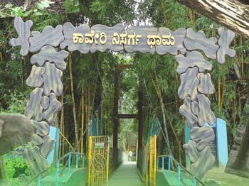
Kaveri Nisarga Dhama
Kaveri Nisarga Dhama is an island formed by river Kaveri and is used as a picnic spot near Kushalnagar in the district of Kodagu. It is approximately 3kms from Kushalanagara, off the State Highway and 30kms from Madikeri. It is a 64-acre island, with lush foliage of thick bamboo groves, sandalwood and teak trees and surrounded by the Kaveri river. The island is accessible through a hanging rope bridge. There are deer, rabbits, peacocks, and a childrens playground and orchidarium. Visitors are allowed to get into water at a few shallow and safe points along the river. Elephant rides and boating are some of the other attractions. It also has a forest department run guest house and treetop bamboo cottages.

Bhagamandala
Bhagamandala is a pilgrimage place in Kodagu district. It is situated on the river Kaveri in its upstream stretches. At this place, the Kaveri is joined by two tributaries, the Kannike and the mythical Sujyoti river. It is considered sacred as a river confluence(Triveni Sangama). It is a common practice for pilgrims to take a dip in the triveni sangama and perform rituals to their ancestors before proceeding to Talakaveri, the birthplace of Kaveri. A short distance from the triveni sangama, there is a famous temple known as Sri Bhagandeshwara temple, where Bhagandeshwara (Ishwara), Subramanya, Mahavishnu and Ganapati idols are installed. This place is also known as Bhagandeshwara Kshetra, from which the name Bhagamandala is derived. The temples in this area are built in Karavali(West Coast) style.
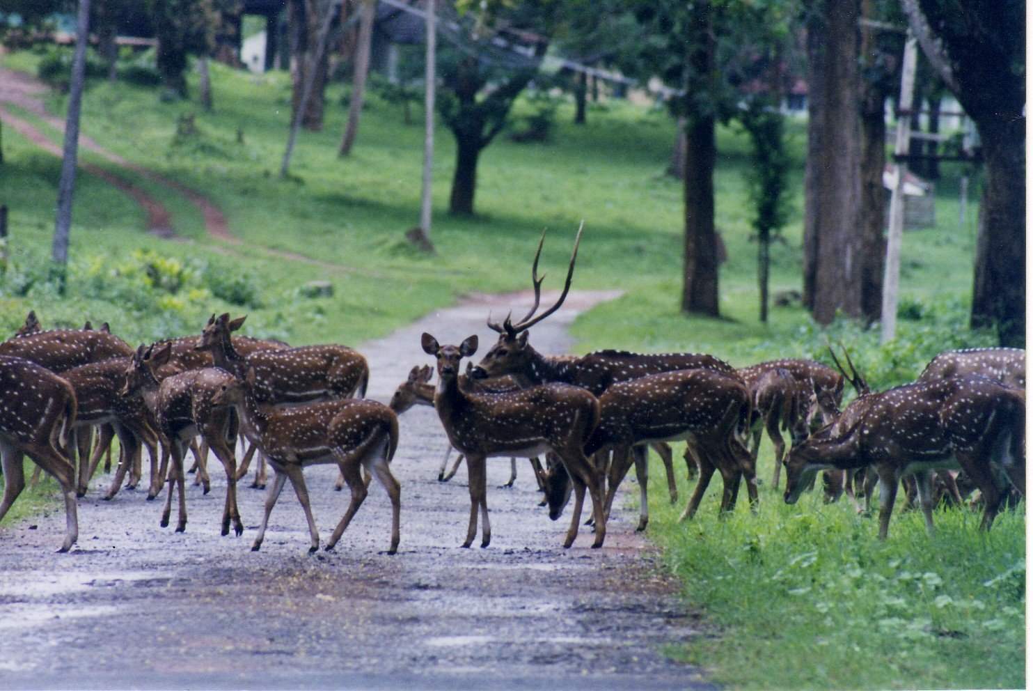
Nagarahole
Nagarahole is named after Nagarahole (Cobra river in the local language, Kannada), a winding river which runs eastwards through its centre. Situated in the two districts of Mysore and Kodagu in the state of Karnataka. It was originally constituted into a sanctuary in the year 1955 covering an area of 258 sq. Kms and subsequently enlarged to include the adjoining areas of Mysore district and now extends over an area of 643.39 sq. kms which was given the status of a National Park in 1983. The birth of Nagarahole National Park can be traced to the notification of 285 Sq. km. Game Reserve way back in 1955, which included the reserve forests of Arkeri, Hatgat and Nalkeri in Kodagu. Subsequently, in 1974, reserved forests from the adjoining Mysore district were added to the Nagarahole Game Reserve, which was upgraded to the status of a National Park covering 643 sq. km.
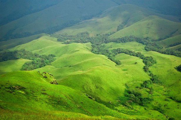
Mandalpatti
The Mandalpatti hills are situated at a distance of 30 kms from the Madikeri town which comes enroute the famous Abbey falls. There is a well connected system of roads which deviates from the Abbi falls and reaches Mandalpatti. The approximate difference in distance of both the locations is just 4 kms. The trekking route in Mandalpatti is one of the finest in the Pushpagiri range of forests, which spreads from the region of Subrahmanya to Somwarpet. This place is truly a marvel of nature as visitors throng to the place for the early morning glimpse of the sun rising over the mist laden peaks of the western ghats. Besides, Mandalpatti usually has salubrious climate all year around except for the monsoon period, from June to mid August. It is advised to start the trek after getting equipped with all necessary provisions as there are very few places to rest or shops having refreshments along the way. The best time to visit this region is usually once the monsoon has passed and when the cold winter sets in. For all those individuals who possess a streak of adventure would surely admire the breathtaking views which can be witnessed during the winter months.
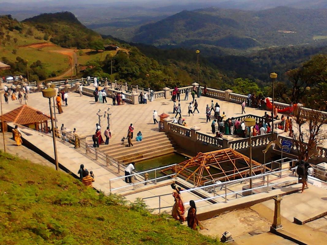
Talakaveri
Talakaveri is the place that is generally considered to be the source of the river Kaveri. It is located by Brahmagiri hill near Bhagamandala. A tank or kundike has been erected on a hillside, at the place that is said to be the origin. It is also marked by a small temple, and the area is frequented by pilgrims. The river originates as a spring feeding this tank, which is considered to be a holy place. The waters are then said to flow underground to emerge as the river some distance away.